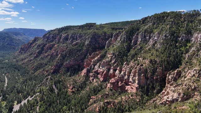
Sedona is usually introduced by its cathedrals of sandstone, but there’s another side to the story. Oak Creek and its tributaries cut cool corridors through the desert, feed riparian oases, and in the right conditions even form seasonal waterfalls.
The mix of water and rock makes for a rare experience in Arizona: shady creekside trails with towering crimson walls overhead.
After more than a decade of field visits and research, the hikes below stand out as the best ways to pair creek time with world-class red rock scenery.
You’ll also find practical notes about shuttles, passes, monsoon safety, and Leave No Trace habits that protect Sedona’s fragile ecosystem.
Quick Picks at a Glance
- Best for a swim and easy scenery: Slide Rock State Park along Oak Creek
- Best “after-rain” waterfall photo: Seven Sacred Pools on Soldier Pass
- Best shady creek hike for all-day exploring: West Fork of Oak Creek
- Best short canyon stroll with a chance at a waterfall after storms: Fay Canyon
- Best swimming holes outside town with a bit of adventure: Bell Trail into Wet Beaver Wilderness, including “The Crack” area of pools and small falls
Before You Go
You’ll enjoy the hikes much more if the basics are squared away first:
Shuttles and Parking
Two of the most popular trailheads, Cathedral Rock and Soldier Pass, now rely on a free shuttle system. During shuttle operating hours the parking lots are closed.
The easiest approach is to park at a Park & Ride and ride the bus directly to the trailhead. The Sedona Shuttle website posts current timetables and seasonal adjustments.
Red Rock Pass and Other Fees
Many trailheads on the Red Rock Ranger District require a Red Rock Pass or an equivalent interagency pass. Passes can be purchased at kiosks, visitor centers, or digitally.
Slide Rock State Park has its own entry fee separate from the Red Rock system. Always verify at the kiosk or online before setting out.
Water, Weather, and Monsoon Season
Oak Creek can rise rapidly in summer storms. Even if skies are clear overhead, rain in the high country can surge into the canyons hours later.
Rangers sometimes close creek areas when flood warnings go into effect. In July and August the National Weather Service posts daily flash flood outlooks; it’s worth checking the gauges and forecasts before you lace up your boots.
Leave No Trace and Fragile Soils
Sedona welcomes millions of visitors each year. Staying on durable surfaces, packing out trash and pet waste, and respecting signage are essential steps to protect the desert crust and keep Oak Creek clean.
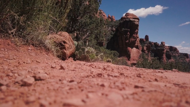
The Hikes
Each trail below blends red rock scenery with the cool relief of creeks, pools, or seasonal falls. Every one has its own character, from family-friendly strolls to full-day canyon treks, so you can pick the setting and pace that fits your day.
1. Slide Rock State Park
Slide Rock is the most famous swimming hole in Arizona, with natural sandstone flumes polished smooth by centuries of running water.
The cold creek, the orchard remnants, and the towering canyon walls create a mix of recreation and history.
Route
A short walk from the parking lot leads to the creek area. Several easy nature trails and orchard paths offer a chance to stretch your legs between swims.
Distance
Flexible. The main pools are only a few minutes from the lot.
Good to know
Glass containers are prohibited. Rangers will close the slide area if flash flood warnings are issued. Arrive at opening time on hot days.
What You’ll See
The creek cuts a wide amphitheater through orange and red sandstone. In late afternoon the cliffs glow with reflected light while swimmers race down the flume.
Logistics
State park entrance fee and on-site parking. In peak season, the lot fills quickly.
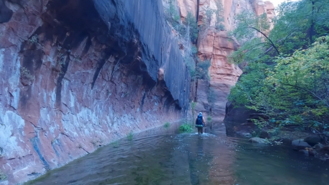
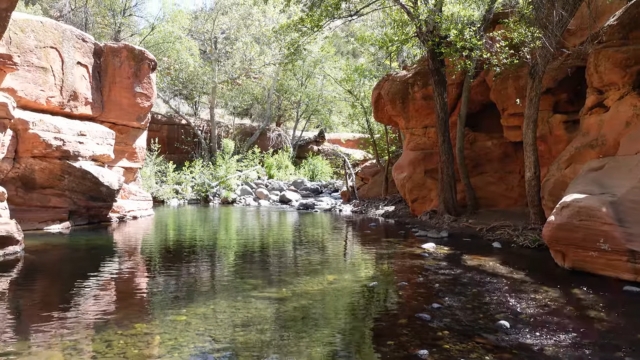
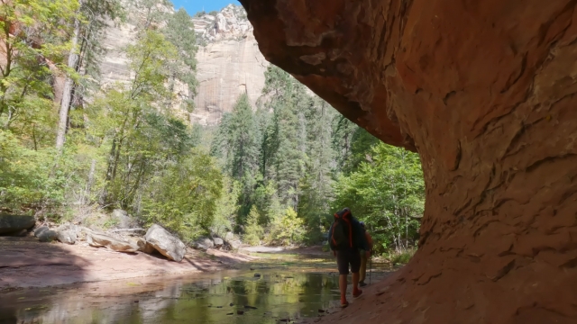
2. West Fork of Oak Creek
West Fork is the classic Sedona creek hike, beloved for its cool shade, soaring walls, and vibrant fall colors. The creek meanders beneath red rock pinnacles and through stands of cottonwoods and maples.
Route
Begin at Call of the Canyon day-use area. The trail follows the creek upstream, weaving between banks and crossing the water dozens of times.
Distance
About 6.5 to 6.75 miles round trip before the wilderness boundary. Turn around whenever you like.
What You’ll See
Sheer cliffs, swirling sandstone corridors, and constant water underfoot. In autumn, yellow leaves drift across red pools. In spring, wildflowers grow along the canyon floor.
Logistics
Fee site that typically honors Red Rock or Coconino passes. Arrive early to secure parking.
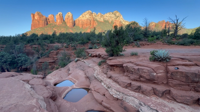
3. Soldier Pass to Seven Sacred Pools
View this post on Instagram
Seven Sacred Pools are carved basins in slickrock connected by small pour-overs after rain. When water flows, it creates one of the most photogenic spots in Sedona.
Route
From Soldier Pass Trailhead or via connecting paths from Jordan Road, follow Soldier Pass Trail to the pools.
Distance
Roughly 0.7 miles one way from the trailhead to the pools. Many hikers continue to Brins Mesa for bigger views.
What You’ll See
Pools etched into the sandstone, often mirror-still during dry spells and spilling over in a chain of cascades after storms. Red rock towers rise in the background.
Logistics
When the Sedona Shuttle is operating, the Soldier Pass parking lot is closed. Use the Park & Ride.
The off-highway vehicle road requires a separate daily permit and high-clearance 4×4 but does not allow parking at the trailhead itself.
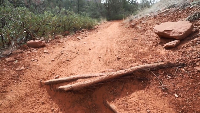
4. Fay Canyon
Fay Canyon offers a mellow path into a shady canyon. After significant rainfall a thin waterfall appears at the headwall.
Route
From the Fay Canyon parking area off Boynton Pass Road, follow the main trail into the canyon until it ends at the headwall.
Distance
About 2.4 miles round trip on an easy grade.
What You’ll See
Crimson walls rising above a floor dotted with oaks and junipers. Occasional bird calls echo off the rock. After storms, water seeps or falls along the back wall.
Logistics
Accessible by paved road. Sturdy shoes help with sandy stretches.
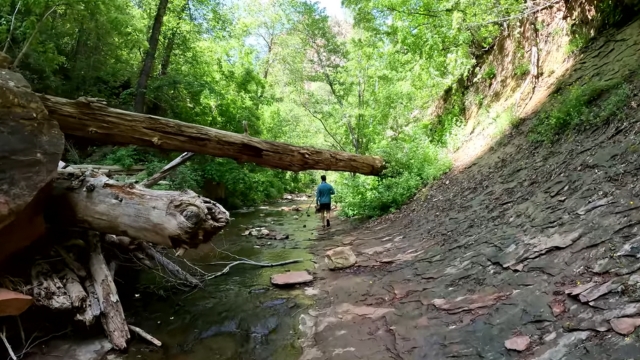
5. Bell Trail into Wet Beaver Wilderness
@sacredssprings📍Bell trail—Wet Beaver Wilderness Sedona, Arizona♬ Sinner – Ark Patrol
Bell Trail follows Wet Beaver Creek into a designated wilderness southeast of Sedona. It is the area’s best choice for deeper swim holes and sustained creek time.
Route
From the Beaver Creek area, take Bell Trail No. 13. Most visitors aim for the pool complex nicknamed “The Crack,” a series of emerald pools and short cascades framed by red sandstone.
Distance
Moderate out-and-back day to reach “The Crack.” The trail continues farther upstream for a longer trek.
What You’ll See
Clear water with fish darting between boulders, layered sandstone benches high above the stream, and juniper-studded ridges in every direction.
Logistics
Shade increases as you near the water. Pack more drinking water than you think you need. Respect the quiet of the wilderness area and other swimmers.
Bonus Spots
- Crescent Moon Picnic Site (Red Rock Crossing): Famous view of Cathedral Rock reflected in Oak Creek. Level paths and creek access. Excellent for families and sunset photography.
- Grasshopper Point: Deep swimming hole under tall canyon walls. Access to Allen’s Bend and Huckaby trails for more views.
At-a-Glance Comparison Table
| Hike or Site | Typical Distance | Water Feature | Signature Red Rock View | Pass or Fee | Notes |
| Slide Rock State Park | Flexible, short | Natural slide and pools on Oak Creek | Oak Creek Canyon walls | State park fee | Arrive early in summer; rangers may close creek area during flash flood warnings. |
| West Fork of Oak Creek | ~6.5 to 6.75 miles RT | Constant creek; many crossings | Sheer sandstone walls, pinnacles | Fee site that honors Red Rock or Coconino passes | Shade, fall colors, very popular. |
| Soldier Pass to Seven Sacred Pools | ~1.4 miles RT to pools | Seasonal pools and small cascades | Spires and buttes above pools | Shuttle access when operating | Parking lot closed during shuttle hours; OHV road requires separate permit. |
| Fay Canyon | ~2.4 miles RT | Seasonal waterfall at headwall | High red rock canyon walls | Red Rock Pass area | Easy grade, shady pockets. |
| Bell Trail to Wet Beaver Creek | Half day to “The Crack” area | Swim holes and short cascades | Red rock benches above creek | Some areas honor Red Rock or Coconino passes; check site | Wilderness character increases as you go upstream. |
| Crescent Moon Picnic Site | Short walks | Oak Creek access | Cathedral Rock from Red Rock Crossing | Day-use fee; pass accepted | Prime sunset angle, family friendly. |
| Grasshopper Point | Short walks | Deep swim hole on Oak Creek | High canyon walls | Day-use fee; pass accepted | Access to Allen’s Bend and Huckaby. |
How to Plan Your Day Around Water and Rock
Planning a Sedona hike isn’t just about picking a trail. Timing, weather, and access shape the experience as much as the scenery does.
A little foresight here can mean cool creek time, red rock views, and fewer surprises once you’re out on the trail.
Check Weather and Water Levels
Sedona’s waterfalls are mostly seasonal. A day or two after heavy rain is the sweet spot for Seven Sacred Pools and Fay Canyon. Oak Creek flows year-round but changes depth and speed with the seasons.
Wet Beaver Creek also runs all year, but scout the depth before you jump. In July 2021, heavy rain upstream produced multiple peak flows in Oak Creek within hours, a reminder of how quickly conditions can shift.
Rangers act on these warnings immediately, so it pays to have a backup plan.
Choose the Right Access
Shuttles eliminate parking headaches. If your plan includes Soldier Pass or Cathedral Rock, use the free shuttle and skip the frustration of circling for a spot. Carry the right pass.
The Red Rock and Coconino passes cover many day-use sites, but not all. Double-check online or at kiosks to avoid a ticket.
Pack for Creeks and Slickrock
- Closed-toe shoes with good grip for creek beds and sandstone.
- Extra drinking water even when hiking near water.
- A small trash bag for wrappers and micro litter.
Seasonal Waterfall Reality Check
- Best waterfall odds: One to two days after heavy rain or during spring snowmelt. Seven Sacred Pools link together, and Fay Canyon’s back wall often shows a thin veil of water.
- Year-round moving water: Oak Creek in Oak Creek Canyon, including Slide Rock and West Fork.
- Reliable swim holes outside town: Wet Beaver Creek’s pools, especially at “The Crack.”
Sample Two-Day Itinerary
Planning to fit all that scenery and creek time into just a couple of days? Here’s a quick sample itinerary that strings together the standout hikes, swim spots, and photo stops so you can experience Sedona’s watery side without feeling rushed.
Day 1
Morning: Take the Sedona Shuttle to Soldier Pass and hike to Seven Sacred Pools. Continue to Brins Mesa for a higher vantage if you have the time and energy.
Afternoon: Cool down at Crescent Moon Picnic Site and photograph Cathedral Rock reflected in Oak Creek. Evening: Sunset along the creek and return to town for dinner.
Day 2
Morning into early afternoon: Hike West Fork of Oak Creek for a shady, water-rich canyon walk with classic red rock formations.
Late afternoon: Drive north to Slide Rock State Park for a cold dip before heading back through red rock country. For a deeper swim day, swap in Bell Trail to Wet Beaver Creek. Lounge at the pools and return for a red rock sunset in Sedona proper.
Responsible Hiking
- Stay on trail and on durable surfaces. Sedona’s desert crust and riparian zones are sensitive. Shortcuts widen trails and accelerate erosion.
- Share with care. Yield uphill, let faster users pass, and keep voices low in narrow canyons.
- Mind the water. Use toilets at trailheads and pack out pet waste to protect Oak Creek’s quality.
FAQs
Final Tips
- Start early, especially on summer weekends.
- Bring water sandals or shoes you are willing to get wet for creek crossings at West Fork and Wet Beaver Creek.
- Respect closures and ranger guidance during monsoon surge days. If warnings go out, enjoy a viewpoint hike away from narrow creeks and return for water time when levels settle.
Sedona’s water-rich hikes give you a way to cool off, photograph something rare in the desert, and see the region’s red rock scenery from an entirely different angle.
With the right timing and preparation, you can catch seasonal waterfalls, swim in emerald pools, and still be back in town for a cold drink at sunset.
Whether it’s your first trip or your fifteenth, the canyon floors of Oak Creek and its tributaries will reward you with shade, color, and a side of Sedona that few expect.