Utah is a state best known for its towering red rock arches, desert plateaus, and snowy peaks. But there’s another Utah most people never see, the one hidden below the surface.
Beneath the cliffs and canyons lies a vast and wild underground world: deep caves, flowing rivers you’ll never spot from the road, and geological systems that have taken millions of years to carve into place.
What makes Utah’s subterranean scene so unique is the sheer variety of how it formed. Volcanic flows, limestone erosion, tectonic shifts… they’ve all played a part.
In fact, some rivers here begin underground and only show themselves in a final flourish, like at Cascade Falls, while others, like those beneath Neff’s Cave, never really break through to the surface at all.
It doesn’t matter if you’re a weekend hiker or a hardcore vertical caver; there’s something below Utah’s crust that will leave you stunned if you know where to look.
1. Cascade Falls
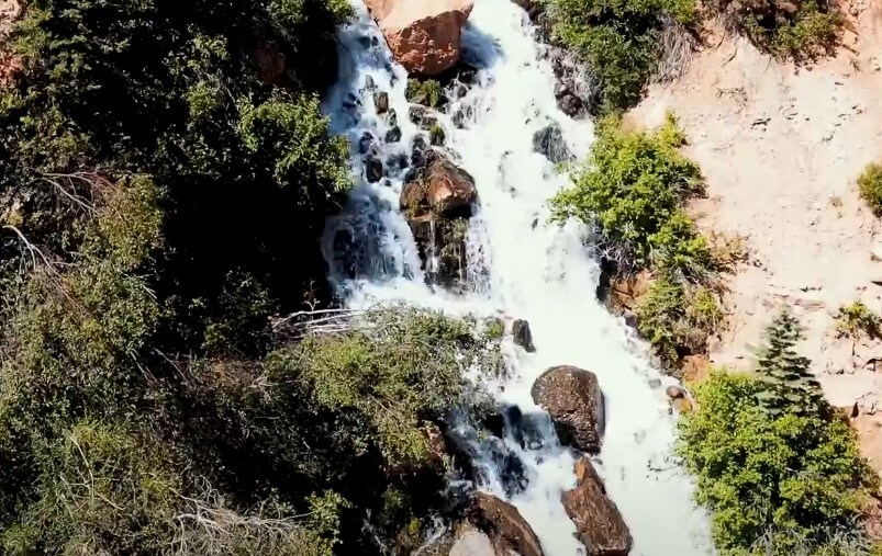
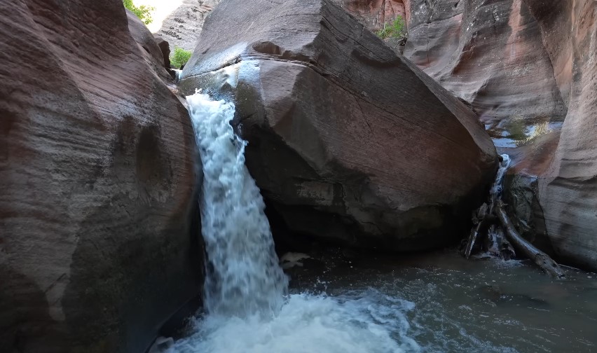
Located just outside Cedar Breaks National Monument near Navajo Lake, Cascade Falls is one of the few places in Utah where you can see an underground river suddenly reveal itself.
One moment it’s hidden, coursing silently through limestone, and the next, it bursts out of the cliff face and tumbles into the Virgin River watershed below.
How It Formed
The story starts with Navajo Lake. Thousands of years ago, a lava flow blocked a narrow valley on the Markagunt Plateau, creating a natural dam.
The lake that formed behind it eventually started draining through sinkholes in the porous Claron Formation, a soft, limestone-rich rock layer.
Over time, that water carved a mile-long cave channel beneath the ground. That’s where the river now flows, completely hidden, until it finally exits as a vertical stream pouring out of a cliff at Cascade Falls.
How to Get There
- Trailhead: Forest Road 054 off Highway 14
- Distance: 1.2-mile round-trip
- Terrain: Moderately flat, with panoramic views of Zion on a clear day
The trail is manageable for most hikers, but there’s a drop-off along the edge, so keep a safe distance, especially if the ground is wet or icy.
There’s a pit toilet at the trailhead, but that’s about it, so bring water and good shoes.
What to Know Before You Go
- The cave system behind the falls is closed to the public due to unstable conditions and low oxygen levels.
- The waterfall’s intensity depends on how full Navajo Lake is. Spring runoff tends to make it dramatic; by late summer, it might just trickle.
- It’s a great choice for families or casual hikers who still want to experience something geologically significant.
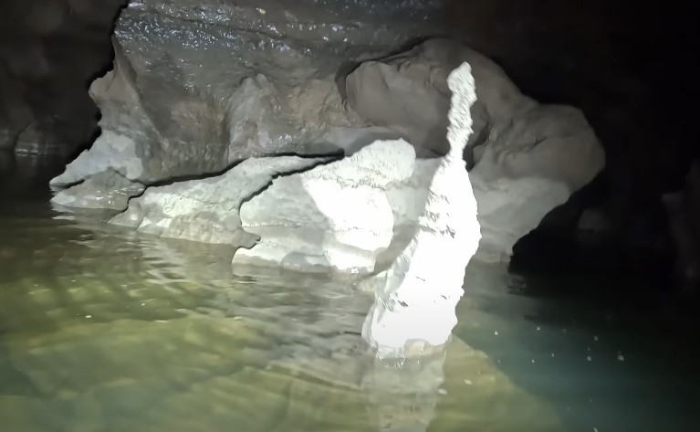
2. Neff’s Cave (One of the Deepest Caves in North America)
Now let’s head underground, way underground. Hidden beneath Mt. Olympus in the Wasatch Mountains east of Salt Lake City lies a cave most people don’t even know exists.
What Makes It Special
Neff’s Cave drops over 1,160 feet deep, making it one of the deepest caves in North America. It’s dangerous, technical, and wild. A river runs below it, although it can’t be seen from the surface or even most chambers, due to the tight vertical shafts and winding rock corridors.
The cave sits on the Wasatch Fault, which plays a huge role in shaping its internal structure. As faults shift and rocks fracture, it opens pathways for water to seep in and start the slow process of limestone erosion.
Access and Safety
- Restrictions: Very limited access, typically allowed only to skilled caving teams
- Requirements: Helmets, climbing harnesses, ropes, lights, oxygen monitoring gear
- Permits: May be needed via local caving groups or the Forest Service
It’s not for casual adventurers. In fact, it was first discovered by two teens, John and Jamie Lyon, back in 1949, though full exploration has taken decades due to the sheer technical difficulty.
If you’re curious but not quite ready to go full-on spelunker, you can still appreciate Neff’s Cave from above.
The Mt. Olympus trail gives you great views of the region, and just knowing what lies beneath adds a sense of mystery to the mountain.
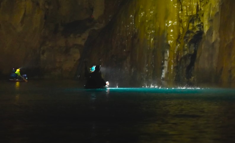
3. Main Drain Cave (Utah’s Fourth-Longest Cave with Flowing Groundwater)
View this post on Instagram
Tucked into the Alpine Karst Glacier basin near Logan Canyon, Main Drain Cave is lesser-known even in caving circles, yet it’s a geological heavyweight.
Cave Specs
- Depth: 1,127 feet
- Length: Over 2 miles
- Hydrology: Active groundwater system shaped by snowmelt
Water plays a big role in the cave’s structure. Though there’s no large visible river, the constant movement of snowmelt through underground passages suggests a significant hydrological system.
Main Drain is one of the best examples in Utah of how groundwater shapes deep karst caves.
For Cavers Only
Like Neff’s, Main Drain isn’t something you wander into. Vertical drops, rope ascents, and tight squeezes make it a serious commitment. You’ll need to coordinate access with either the Bureau of Land Management or a local caving organization.
Despite the danger, for experienced cavers, it’s a dream. The echo of water in the depths and the geological variety within the passages make every trip different.
Other Caves with Hidden Water Systems
While Cascade Falls, Neff’s, and Main Drain offer the most dramatic interactions with underground water, Utah has other sites worth noting, some better-known, some still under the radar.
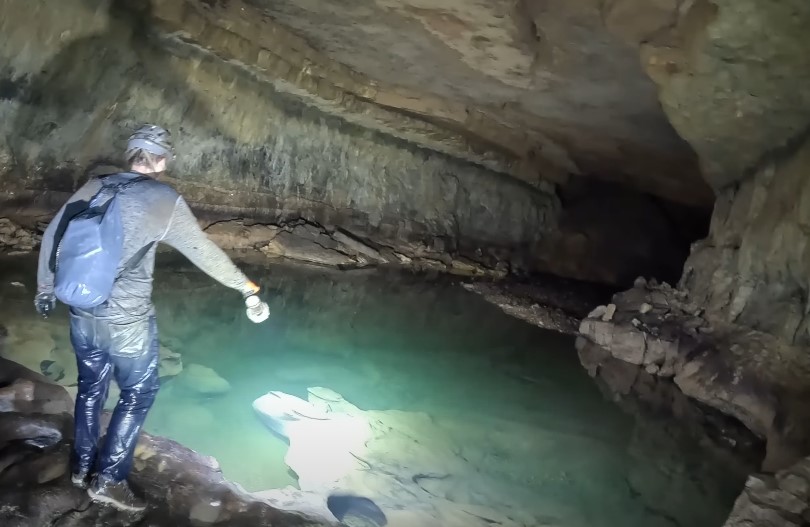
Timpanogos Cave National Monument
- Location: American Fork Canyon
- Water Feature: Underground pools formed by slow seepage
- Access: Guided tours only, seasonal (May-October)
This system of three connected caves, Hansen, Middle, and Timpanogos, offers an easy intro to Utah’s underground water world.
While you won’t find a flowing river, the still, reflective pools inside show how water continues to shape the cave slowly and quietly. It’s a great family-friendly stop with educational guides and excellent conservation practices.
Moaning Cavern
- Location: Duchesne County
- Water Feature: Unseen water movement, audible in the form of haunting echoes
- Access: Undeveloped; check locally for updates
You won’t find much official info on Moaning Cavern, but local explorers report eerie sounds that resemble groaning or moaning, likely caused by underground water movement through tight rock spaces.
It’s one of those places that fuels local legends and might one day reveal more hydrological secrets.
Bloomington Cave
- Location: Near St. George
- Length: 1.43 miles
- Water Feature: Seepage in certain areas, especially after rainfall
- Access: By permit only, limited to 3 small groups per day
Bloomington is known for its maze-like structure and extreme darkness. It doesn’t have a river, but some passages show clear signs of moisture and slow water flow.
It’s still a technical cave, requiring helmets and at least three light sources per person. Permits are free but must be reserved ahead of time via the BLM.
What to Know Before Going Underground
Exploring Utah’s caves isn’t like a walk through a national park. Some systems are extremely remote, others can flood, and many have limited oxygen or sharp vertical drops.
Here’s what you should keep in mind:
Know Your Cave Type
| Cave Name | Best For | Water Feature | Access Level |
| Cascade Falls | Casual hikers | Visible waterfall | Easy |
| Neff’s Cave | Expert cavers | Underground river | Restricted |
| Main Drain Cave | Expert cavers | Groundwater system | Restricted |
| Timpanogos Cave | Families/tourists | Underground pools | Guided tour only |
| Moaning Cavern | Adventurers | Echoing water sounds | Limited info |
| Bloomington Cave | Intermediate cavers | Water seepage | Permit required |
- Helmet with mounted headlamp
- Extra light sources (2 backups)
- Climbing harness and ropes (for vertical caves)
- Waterproof boots
- Protective gloves and knee pads
- Emergency water and food
- Oxygen monitor (for deep systems)
Don’t Skip the Permits
Neff’s, Main Drain, and Bloomington all require coordination with federal or local authorities. Always double-check access rules before heading out. Even popular areas like Timpanogos have seasonal restrictions.
Go With a Group
Never cave alone. Even skilled explorers run into trouble. A team gives you backup, better safety, and a more rewarding experience overall.
What Makes Utah’s Underground Rivers So Unique
Utah isn’t the only state with limestone caves or hidden rivers, but few places offer such a diverse geological story. The Claron Formation around Cascade Falls shows how water works slowly and steadily, dissolving limestone to create mile-long channels.
At Neff’s, the Wasatch Fault is responsible for massive vertical fractures that allow deep river systems to form. And in places like Main Drain or Moaning Cavern, snowmelt and glacial activity are still shaping the ground beneath our feet.
It’s a landscape that’s still alive: shifting, dripping, echoing.
Final Thoughts
Utah’s underground rivers and caves aren’t just holes in the ground. They’re part of an active, ancient system that tells the story of how the Earth moves, breaks, and heals over time.
It doesn’t matter if you’re gazing at the sudden emergence of water at Cascade Falls or rappelling into the silence of Main Drain Cave, you’re experiencing something rare – a glimpse into the part of the world most people never see.
For casual hikers, Cascade Falls offers a safe and beautiful entry point. For trained adventurers, caves like Neff’s and Bloomington promise raw, unfiltered exploration. Just be sure to go prepared, check access rules, and always leave the underground world better than you found it.
And if you’re standing at the edge of a waterfall coming out of solid rock, take a moment. You’re looking at thousands of years of history, pouring out right in front of you.