The red cliffs and spire-filled amphitheaters of Bryce Canyon draw hundreds of thousands of visitors every year. But just beyond the park’s winding roads and lookout points lies a quieter, more weathered piece of Utah’s story.
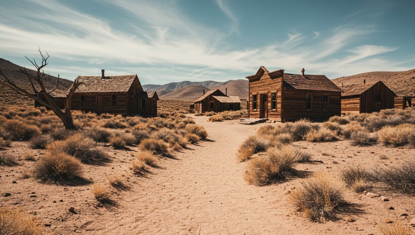
Scattered across the surrounding high desert and alpine valleys are ghost towns – settlements once full of ambition, now reduced to sun-bleached ruins and fading cemetery headstones.
For anyone curious about the lives of early Utah settlers, a visit to one of these historic towns near Bryce Canyon can feel like paging through a dusty journal written in timber, stone, and soil.
They don’t have gift shops or long lines. What they do have is a sense of place that hasn’t been polished for tourists. And that’s exactly the appeal.
Let’s take a closer look at three such towns – Widtsoe, Osiris, and Old Irontown. Each one tells a different story. Each is still standing, at least in part. And all are reachable for anyone willing to leave the main road behind.
1. Widtsoe Ghost Town
Where Farming Dreams Met Harsh Reality
Getting There
Widtsoe sits about 16 miles northeast of Bryce Canyon, nestled in John’s Valley along the East Fork of the Sevier River.
You’ll take Highway 22, a two-lane road that’s quiet, open, and framed by classic Utah scenery – red rock, scrubby pines, and long, flat horizons.
A Town Built on Dry Farming
The town’s story starts in the early 1900s with Jedediah Adair, a farmer who had a knack for growing crops in one of the driest regions of the state. At first, he called the settlement Adairville.
Over time, it was renamed a few times before becoming Widtsoe in 1917, after John A. Widtsoe, president of the University of Utah and a proponent of dryland agriculture. For a brief window – about 1912 to 1919 – the town boomed.
Not by mining standards, but by farming ones. It had a post office, sawmills, hotels, a church that also served as a school, even a candy plant. The U.S. Forest Service moved its district office there. By 1919, roughly 1,100 people lived in Widtsoe.
That’s a serious population for the time and place. But then the drought came. Crops failed. A new irrigation system and a creamery were too little, too late. By the mid-1930s, the Federal Resettlement Administration began buying up land, and by 1938, the last families had packed up and left.
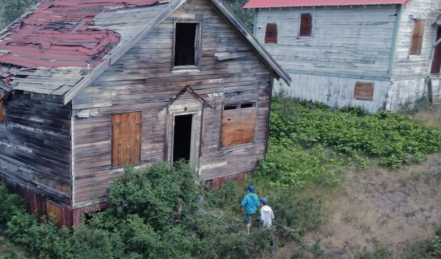
What’s Left Today
A few buildings remain. The most prominent is the old church-school, which still stands at the edge of the settlement.
There’s also a small scattering of homes in various states of collapse and a cemetery that mixes old, crumbling markers with more recent additions from local families who still maintain ties to the area.
But you can walk around the cemetery, view the church, and photograph the town without disturbing anything.
| Aspect | Details |
| Location | John’s Valley, 16 miles NE of Bryce Canyon |
| Founded | Early 1900s by Jedediah Adair |
| Peak Population | ~1,100 (1919) |
| Notable Features | Church/school building, cemetery, remnants of homes |
| Access | Highway 22; road is well maintained |
| Tips | Respect property lines; no amenities on-site |
Why It’s Worth Visiting
There’s something deeply quiet about Widtsoe. Not empty – just quiet in a way that asks you to pay attention. It’s a great stop for photographers and anyone interested in how people once tried to make a living in a high-altitude desert.
It’s also a humbling reminder that even with determination and planning, nature usually has the final say.
2. Osiris Ghost Town
A Mill, a Barn, and Miles of Stillness
How to Get There
Osiris lies about 10 miles south of Antimony, not far from Otter Creek State Park. It’s remote, and you’ll likely be the only visitor when you get there.
If you’re driving from I-70 in Salina to Bryce Canyon, a short detour adds about 20 minutes to the trip – but the drive itself is a highlight, especially for those who love long, open roads.
A Town That Left Few Clues
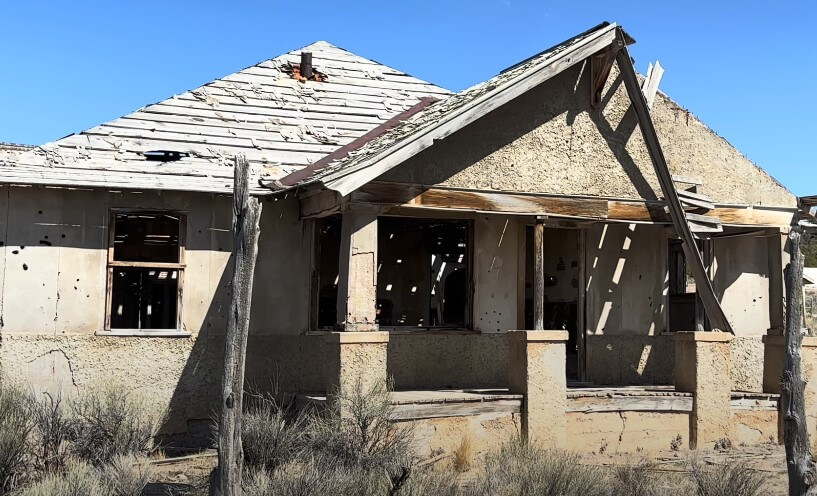
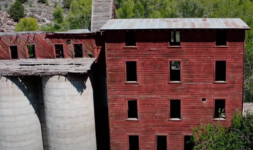
There’s not much written history about Osiris. It likely grew around a small-scale milling operation and possibly served as a farming or mining hub in the early 1900s. What’s clear is that it didn’t last long. Today, three buildings remain.
The centerpiece is an old stone-and-concrete mill that looms over the road like a forgotten fortress. A crumbling barn sits just across the way, and if you follow the narrow dirt road down toward the river, you’ll come across a couple of additional ruins.
What You’ll See
You can’t go inside the buildings – everything’s fenced off and marked with “No Trespassing” signs – but you can get a close look from the road and a short walking trail.
Expect to spend about half an hour here, especially if you want to take photos or explore the area around the river. And if you’re feeling curious, head about 15 miles south to visit the Widstoe Cemetery.
| Aspect | Details |
| Location | 10 miles south of Antimony, near Otter Creek State Park |
| Surviving Buildings | Three: old mill, fragile barn, minor ruins by the river |
| Access | Remote drive; ~20 minutes longer than I-15 route |
| Visit Duration | ~30 minutes |
| Tips | Check road conditions; follow “No Trespassing” signs |
| Nearby | Widstoe Cemetery (15 miles south) |
Why It’s Worth Visiting
Osiris feels like a blink in time. It’s not flashy or expansive, but it’s surrounded by wide-open country and framed by golden light in the late afternoon. It’s also a reminder of just how many small towns came and went across the American West.
3. Old Irontown Ruins
Industrial Ambition Carved in Stone
Where to Find It
Old Irontown is about 20 miles west of Cedar City, then another five miles south on Old Iron Town Road. It’s farther from Bryce Canyon – about 80 miles – but close enough for a day trip if you’re planning to visit Cedar City.
The site is open during daylight hours year-round, and there’s no fee to enter. It’s managed as a historical park, which means it’s a bit more maintained than other ghost towns.
Iron in the Desert
Old Irontown was founded in the 1850s by Mormon pioneers. The goal was straightforward: build an ironworks to support the expanding settlements in southern Utah. For a while, it worked.
The town had a foundry, blacksmith shop, schoolhouse, and even a charcoal kiln shaped like a beehive. But transportation was a nightmare. And when the Panic of 1874 rolled in, money dried up. The operation folded, and the town went quiet not long after.
A Ghost Town With Trails
Old Irontown is perfect for anyone looking for a slightly more structured visit. Two short trails – each about a quarter-mile – wind through the ruins. The main loop highlights the kiln, furnace, grinding stone, and foundry foundations.
The second, called the Nature Trail, leads to the remains of a pioneer cabin and includes signs about local flora and fauna. There are restrooms and a small shaded picnic area on-site.
| Aspect | Details |
| Location | 20 miles west of Cedar City; 5 miles south on Old Iron Town Road |
| Founded | 1850s by Mormon settlers |
| Key Features | Kiln, foundry, grinding stone, nature trail, cabin remains |
| Access | Free and open during daylight hours year-round |
| Facilities | Restrooms, picnic area; no overnight camping |
| Tips | Stop by museum in Cedar City for brochure |
Why It’s Worth Visiting
Old Irontown feels more like an outdoor museum than a forgotten ruin. The trails are well marked, the signage is informative, and the site makes for a great family outing. It’s not just about what’s left – it’s about how clearly the story of the place is still told.
Practical Tips for Visiting Ghost Towns
View this post on Instagram
Exploring historic ghost towns isn’t difficult, but it does require a bit of prep:
- Respect boundaries: Many ruins are on private land. Don’t cross fences or take anything.
- Pack smart: Water, snacks, sunscreen, and good shoes are essential. There’s no food or fuel out there.
- Double-check road conditions: Especially near Osiris. Weather can turn dirt roads into mud traps.
- Bring a camera: The textures, shadows, and structures make for striking photos.
- Go early or late: Midday sun can be harsh. Morning or golden hour makes for better lighting and cooler temps.
Final Thoughts
Widtsoe, Osiris, and Old Irontown aren’t tourist traps. They don’t try to entertain. What they do offer is something quieter and maybe a bit more meaningful – a glimpse into the hopes and hardships of people who built something out of nothing, only to watch it fade away.
If you’re already heading to Bryce Canyon, take the time to add one (or more) of these sites to your trip. You don’t need a tour guide. Just a good map, a curious eye, and a little bit of respect for what’s left behind.