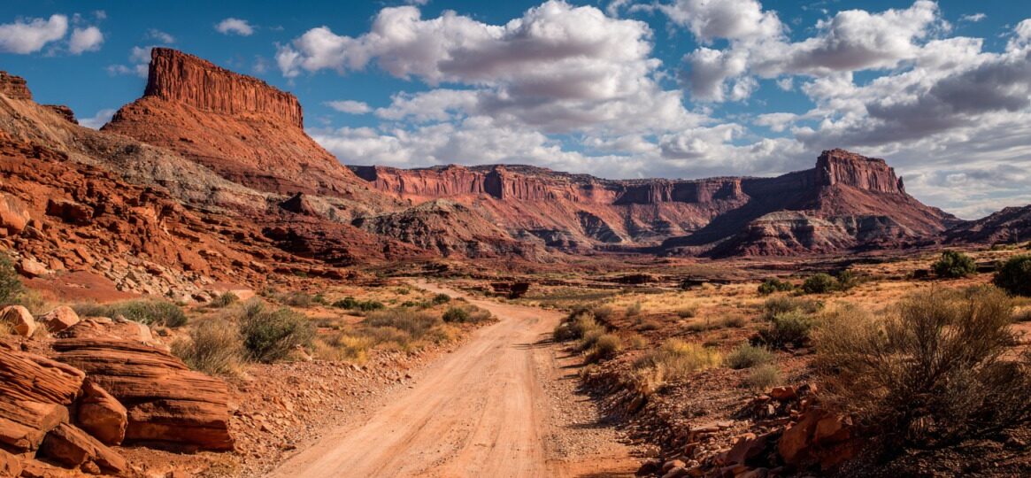
White Rim Road forms a remote, roughly 100-mile loop inside the Island in the Sky district of Canyonlands National Park in Utah.
Construction occurred during the 1950s under the Atomic Energy Commission to reach uranium prospects that later closed. Travel follows the top edge of the White Rim Sandstone layer, which gives the route its name and character.
- Airport Tower
- Monster Tower
- Murphy Hogback
- Candlestick
Solitude dominates most of the drive, paired with vast skies, exposed cliffs, and a strong sense of self-reliance that defines one of the most demanding Four Wheel Drive routes in the United States.
Let us talk about it in greater detail.
Permits and Regulations
Permits remain mandatory year-round for every visitor traveling White Rim Road, covering drivers, cyclists, and hikers alike.
Rangers actively enforce permit rules at entry points and along the loop, making advance planning essential for both short visits and multi-day trips.
Day Use Permits
Day access operates under a strict daily limit designed to control congestion and protect road conditions.
Availability splits evenly between online and in person distribution, creating two distinct ways to secure entry.
- Fifty vehicle permits are issued per calendar day
- 25 permits were released online one day in advance
- 52 permits are offered at the visitor center on a first-come basis
- $6 fee for online reservations
- No charge for visitor center permits when available
Day-use access restricts travel to daylight hours only. Overnight stays, roadside sleeping, and campsite use remain prohibited under day use permits, even in emergencies that do not involve vehicle breakdown or safety issues.
Overnight Backcountry Permits
Multi-day travel requires an overnight backcountry permit tied directly to specific campsites along the route.
Reservations operate exclusively through Recreation.gov and follow fixed seasonal release dates that align with expected travel demand.
- March 10 to June 9 trips open November 10
- June 10 to September 9 trips open February 10
- September 10 to December 9 trips open May 10
- December 10 to March 9 trips open August 10
Cost structure applies consistently across seasons. Each reservation carries a $36 base fee, plus $5 per person per night. Campsites with wide exposure and sweeping views, especially White Crack, often sell out within minutes of release.
Additional Rules
@calliemcmuffin What snacks are YOU bringing 🤠🫶🏼✨ #canyonlandsnationalpark #whiterimtrail #offroad4x4 #utahbucketlist #mightyfivenationalparks ♬ Bluest Flame – Selena Gomez & benny blanco
Camping remains limited strictly to designated sites. Dispersed camping anywhere along the road or spur routes violates park regulations.
Pets cannot enter, including animals remaining inside vehicles at overlooks or campsites.
Generators and wood fires remain prohibited to protect air quality and fragile desert soils. Park entry requires a separate fee that applies regardless of permit type.
- $30 per vehicle Canyonlands National Park pass
- America the Beautiful annual pass for frequent national park visitors
Route Overview and Direction Options
White Rim Road forms a complete loop with access points near the Island in the Sky Visitor Center. Entry selection influences traffic patterns, pacing, and overall driving difficulty during the first and final miles.
- Shafer Trail
- Mineral Bottom Road
- Potash Road is often used as an alternate entrance or exit
Clockwise travel starts with the steep Shafer Switchbacks and places major obstacles later in the route as uphill climbs. Murphy Hogback and Hardscrabble Hill feel more controlled when driven uphill, making clockwise travel popular among first-time visitors.
Counter clockwise travel reaches Green River overlooks early and often feels quieter during initial miles, though difficult descents appear later in the loop.
Two-way traffic operates along the entire road, even though many stretches are narrow to a single lane. Pullouts appear intermittently, though reversing may become necessary when vehicles meet in tight sections.
Mileage planning matters due to limited daylight and slow travel speeds. Total distance reaches roughly one hundred miles without detours.
- White Crack Spur adds about 1.4 miles round trip
- Lathrop Canyon Spur descends toward the Colorado River
- Taylor Canyon Spur reaches a remote viewpoint near the Moses and Zeus formation
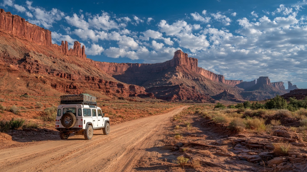
Vehicle and Driving Requirements
High clearance four wheel drive vehicles equipped with low-range gearing remain mandatory. Rangers may deny access to vehicles lacking proper equipment.
All Wheel Drive vehicles do not qualify under park regulations. ATVs, UTVs, and other off-highway vehicles remain prohibited.
- Jeep Wrangler
- Jeep Rubicon
- Comparable body-on-frame four wheel drive trucks and SUVs
Four wheel drive rentals operate in Moab, including companies such as Canyonlands Jeep Adventures. Renters should confirm low-range capability before departure.
Truck campers face strict size limitations due to overhangs and narrow rock corridors.
Height should remain under approximately ten feet, while width must stay near seven feet two inches or less. Removal of camper jacks helps prevent damage through dips and narrow V notches.
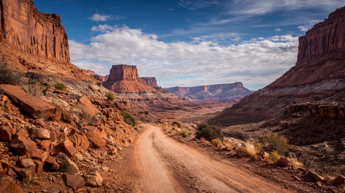
Driving surfaces change constantly along the loop, alternating between dirt tracks, slickrock shelves, deep sand, rocky climbs, and exposed ledges.
- Shafer Trail includes steep switchbacks near the start
- Murphy Hogback presents a long, narrow, exposed climb
- Hardscrabble Hill features tight turns with sharp drop offs
- Labyrinth Canyon includes a narrow ledge road near the loop’s end
Successful travel depends on skill rather than speed.
Drivers must know when to use Four Wheel Drive high versus low, feel comfortable reversing on narrow roads, tolerate exposure without guardrails, and handle flat tires or vehicle recovery in sand or on rock.
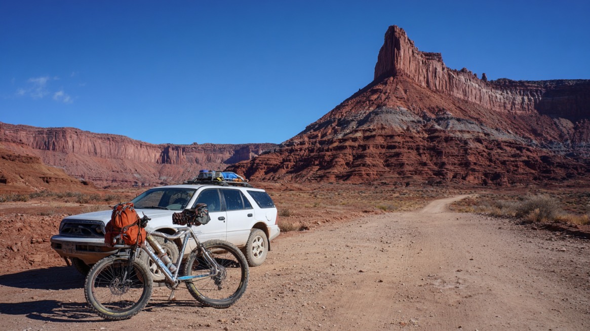
Camping Along White Rim Road
Ten designated camping areas line the loop, each containing one to four individual sites.
Twenty total campsites appear spaced roughly ten to fifteen miles apart, shaping natural stopping points for multi-day travel.
Every camping area includes a pit toilet, while water, trash service, and shade structures remain unavailable.
- White Crack offers a single site with wide open exposure
- Murphy Hogback A sits on a high ridge with strong winds
- Gooseberry A works well for two night itineraries
- Airport D provides increased isolation among Airport sites
- Labyrinth A overlooks the Green River
- Potato Bottom A offers shade near the river, though insects may appear
Reservation strategy strongly affects trip success. Securing campsites four to six months in advance improves availability. Multi-day loops often combine two or three campsites. Two-day itineraries require early starts with midpoint camps such as Murphy or White Crack.
Three-day itineraries allow slower pacing, photography, and side hikes without time pressure.
View this post on Instagram
Safety and Weather Considerations
Seasonal timing shapes both comfort and safety. Spring between March and May and fall during September and October offer the most stable conditions. Summer heat frequently exceeds one hundred degrees Fahrenheit and brings monsoon storms capable of flooding roads.
Winter nights drop below freezing, with snow or ice lingering on shaded switchbacks and occasional closures.
Flood season typically runs early May through late June. Rising Green River levels may block sections of the loop entirely. Storm systems can render roads impassable for days, and flash floods occasionally affect Lathrop, Taylor, and Labyrinth areas.
Conditions shift quickly, making ranger check ins at the Island in the Sky Visitor Center critical before departure.
Communication options remain limited. Cell service improves near Gooseberry and Airport areas but disappears across much of the western loop. AT&T and Verizon provide limited access via La Sal Mountain towers.
- Garmin InReach
- SPOT satellite messenger
Packing List and Preparation Tips
Preparation determines safety and comfort along White Rim Road.
Water supply should reach at least one gallon or four liters per person per day, with an additional reserve recommended during warm months.
Food planning must cover all meals plus extra snacks in case of delays. Fuel capacity must support more than one hundred miles, including detours, since no services exist along the route.
- Tent, sleeping bag, and stove
- Jack, full-size spare tire, air compressor, and tow strap
- Headlamps and spare batteries
- Toilet paper and hand sanitizer
- GPS unit paired with physical maps
- Layered clothing and rain protection
Extras often include camera gear, sunscreen, and a first aid kit.
Planning works best on a structured timeline. Six months ahead suits route planning and campsite reservations. Three months ahead aligns with four wheel drive rental bookings.
Two weeks ahead allows weather monitoring and gear checks. Final preparation one to two days ahead covers food, water, fueling, and last condition reviews.
@calliemcmuffin Driving the White Rim Road in Canyonlands National Park ✨🌙❤️🔥 Backcountry camping & driving permits required along with a high clearance 4×4 vehicle ⚡️ #overlanding #4x4offroad #whiterimtrail #canyonlandsnationalpark ♬ original sound – avery77777
Closing Thoughts
White Rim Road represents a demanding backcountry expedition rather than a casual scenic drive. Careful planning supports safety and enjoyment.
Leave No Trace ethics remain essential. Travel must stay on established routes. Biological soil crusts require strict avoidance. All trash needs packing out.
Quiet zones and wilderness regulations deserve respect. Solitude, dramatic geology, and self-reliance combine to create a powerful desert experience that rewards preparation and patience.