Southern Utah ranks among the top road trip destinations in the United States due to its concentration of dramatic scenery and accessible routes.
Scenic drives offer access to the “Mighty 5” national parks, including:
Travelers encounter vast red rock deserts, deep canyons, and striking geological formations along these roads.
Many routes hold official status as National Scenic Byways or All-American Roads, marking their exceptional visual and recreational value.
Top Scenic Drives in Southern Utah
Southern Utah contains several of the most visually striking road routes in the United States, each offering distinct terrain, elevation changes, and access to national parks and remote areas. The close proximity of these routes allows travelers to transition quickly between vastly different environments.
High plateaus, canyon corridors, and desert expanses appear within a single day of travel, creating a dynamic driving experience that rarely feels repetitive.
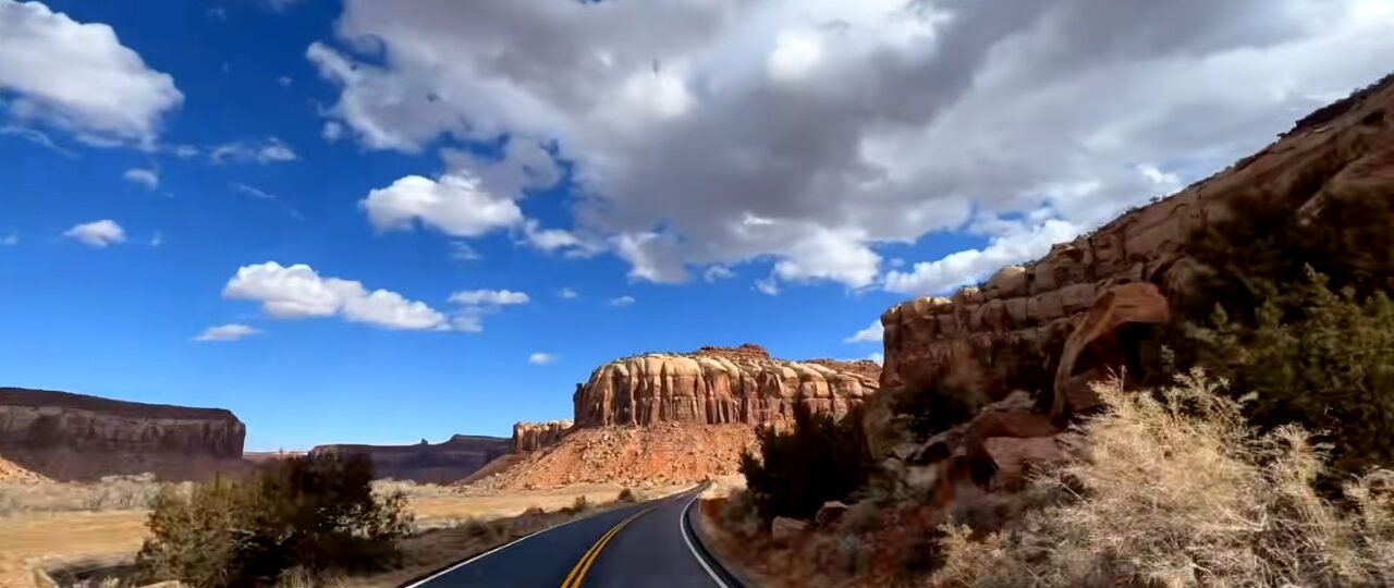
Scenic Byway 12 (Highway 12)
Scenic Byway 12 spans approximately 122 to 123 miles between Panguitch and Torrey, connecting Bryce Canyon and Capitol Reef.
Recognition as an All-American Road places it among the most prestigious scenic routes in the country.
Smooth pavement and well-marked pull-offs make it accessible while still delivering dramatic views across changing terrain.
The route includes several defining segments that shape the experience:
- Dixie National Forest introduces higher elevation with cooler air and dense tree cover
- Grand Staircase-Escalante reveals layered rock formations and expansive desert views
- Hogback sections feature narrow ridgelines with steep drop-offs on both sides
Frequent overlooks provide opportunities to stop and take in sweeping vistas. Shifts between forested areas and exposed desert create a strong contrast that keeps the drive engaging throughout its entire length.
Zion-Mount Carmel Highway / Zion Scenic Drive (Route 9)
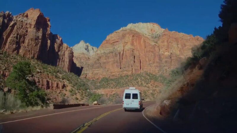
Route 9 runs about 30 miles through Zion National Park and creates a direct path through towering canyon walls. Road design follows the natural contours of the canyon, producing constant visual change as curves reveal new rock formations and vertical cliffs.
Zion-Mount Carmel Tunnel is one of the most notable features along the route. Construction through solid sandstone required careful engineering, and windows carved into the tunnel walls allow brief glimpses of the canyon during passage.
Outside the tunnel, elevation changes provide wider views across the park.
Heavy traffic can occur during peak travel periods, especially near Zion Canyon. Early morning and late afternoon hours often provide a calmer experience with softer lighting across the rock surfaces.
Burr Trail Scenic Backway
@ogborn5 BEST DRIVE FROM BRYCE TO CAPITAL REEF: BURR TRAIL! 10/10 The Burr Trail in Utah is a scenic backcountry route spanning 68 miles, connecting Boulder to Bullfrog, and passing through Grand Staircase-Escalante National Monument, Capitol Reef National Park, and Glen Canyon National Recreation Area. #familyvacation #mighty5 #nationalparks #utah #brycenationalpark #capitalreefnationalpark ♬ Northern Attitude – Noah Kahan & Hozier
Burr Trail presents a more isolated driving experience compared to major paved routes. Located near Capitol Reef, this backway transitions between paved sections and rugged dirt roads as it moves deeper into remote terrain.
Steep switchbacks descend sharply through layered canyon walls, creating a dramatic visual drop. Road conditions can change depending on the weather, with dirt sections becoming rough or muddy after rain.
Limited services and minimal traffic define much of the route, requiring careful preparation before starting the drive.
Open desert stretches provide wide views with little obstruction, allowing travelers to experience a quieter and more secluded setting compared to busier scenic roads.
US Highway 89
US Highway 89 functions as a major north-south corridor across southern Utah, connecting multiple scenic regions and national parks.
Consistent road conditions support long-distance travel, making it a reliable route for linking various destinations.
Connections along this highway create access to several key areas:
- Routes leading toward Bryce Canyon and nearby viewpoints
- Entry points into Grand Staircase-Escalante
- Proximity to Vermilion Cliffs and surrounding desert formations
Intersections with scenic byways allow travelers to branch off easily, creating flexible travel plans that can include both major highways and smaller scenic roads.
Capitol Reef Scenic Drive
View this post on Instagram
Capitol Reef Scenic Drive provides direct access to the central features of Capitol Reef National Park. Waterpocket Fold extends roughly 100 miles, forming a long ridge that defines much of the region’s geology.
Road passes alongside cliffs, domes, and layered rock formations shaped by erosion over millions of years. Visual contrast between lighter and darker rock layers adds depth to the scenery.
Access points along the drive lead to hiking trails and historical sites, including remnants of early settlements.
Paved sections accommodate most vehicles, while unpaved extensions allow deeper access into more remote areas of the park. Changing road conditions create a gradual shift between easily accessible viewpoints and more rugged terrain.
Bryce Canyon Scenic Drive (Route 63)
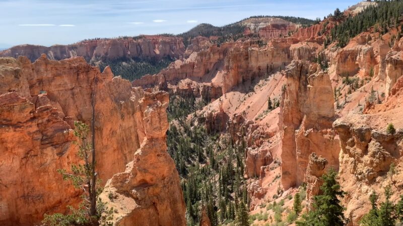
Route 63 runs approximately 10 to 20 miles through Bryce Canyon National Park and offers a concentrated series of viewpoints.
Road design focuses on positioning visitors along the edge of amphitheaters filled with hoodoos.
Key stops along the route include Sunrise Point, Sunset Point, Inspiration Point, and Rainbow Point. Short distances allow travelers to visit multiple viewpoints without extensive driving.
Frequent pull-offs and clearly marked stops make navigation simple, while proximity to trailheads allows quick access to hiking routes descending into the canyon.
Kolob Canyons Road (Zion National Park)
Kolob Canyons Road leads into a less-visited section of Zion National Park, offering a quieter alternative to more heavily trafficked areas. Gradual elevation gain reveals broader views as the road climbs higher into the canyon system.
Red rock formations dominate the scenery, with fewer vehicles on the road creating a calmer driving experience.
Scenic overlooks appear at intervals, providing elevated vantage points across the canyon. Access to hiking trails allows visitors to continue deeper into this quieter section of the park.
Short length makes it easy to include this route as part of a larger trip without requiring significant additional time.
Cedar Breaks Scenic Byway
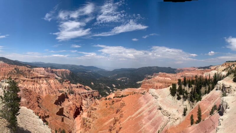
Cedar Breaks Scenic Byway runs at a higher elevation near Cedar Breaks National Monument, creating a noticeable shift in environment compared to lower desert routes.
Cooler temperatures and alpine conditions define much of the drive.
Seasonal changes play a major role in shaping the experience. Late spring and summer bring wildflower displays across open meadows, while colorful rock amphitheaters remain visible throughout the warmer months.
Elevated position provides expansive views across the surrounding terrain.
Winter weather can limit access due to snow, making timing an important factor when planning a visit. Cooler air and higher elevation offer a refreshing contrast during hot summer months in southern Utah.
The Bottom Line
Southern Utah offers a concentrated collection of world-class scenic drives that combine paved accessibility with adventurous backcountry options.
Routes connect national parks, monuments, and vast desert regions, providing a comprehensive view of the region’s geological features and natural beauty.