Tucked deep in the Shawnee National Forest, Bell Smith Springs feels like a secret pocket of the Midwest that forgot it wasn’t the Ozarks.
You’ll find it in Pope County, Illinois, near the small town of Eddyville, where clear turquoise creeks wind through sandstone canyons and lush, fern-filled hollows. It’s not a theme park or a manicured resort. It’s raw, wild, and refreshingly unpolished.
Locals call it one of the crown jewels of southern Illinois hiking, and for good reason. The area holds roughly eight miles of linked trails looping through cliffs, springs, and shaded pools, all carved out by Bay Creek and its tributaries.
Officially, it’s a National Natural Landmark , and once you walk down the old stone stairway into the gorge, you’ll understand why.
Here’s a full guide to the trails, pools, and local know-how to make your day out smooth, safe, and memorable.
Quick Facts
| Category | Details |
| Location | Pope County, near Eddyville, within Shawnee National Forest |
| Status | National Natural Landmark |
| Trail mileage | About 8 miles of interconnecting color-marked trails |
| Signature features | Natural Bridge, Devil’s Backbone, high bluffs, historic stone stairway, deep creek pools |
| Best seasons | Spring through fall, with winter offering quiet solitude |
| Glass rule | No glass containers anywhere in the recreation area |
| Access hours | Day-use, typically 6:00 a.m.–10:00 p.m. |
| Camping | Not in canyon; Redbud Campground nearby |
Orientation
You’ll start from a main parking lot above the canyon , marked by a large trailhead sign and map board.
The stone stairway right at the entrance leads you into the main gorge, where the trails branch out in color-coded loops.
- White blaze: General Area Trail
- Yellow blaze: Natural Bridge Trail
- Blue blaze: Sentry Bluff Trail
- Red blaze: Hill or Mill Branch Trail
All the trails connect, so you can combine them for half-day or full-day outings. The canyon walls, carved by Bay Creek over centuries, create their own microclimate – cooler and more humid, with ferns, moss, and trickling seeps that make even hot summer hikes bearable.
Natural Bridge Trail (Yellow)
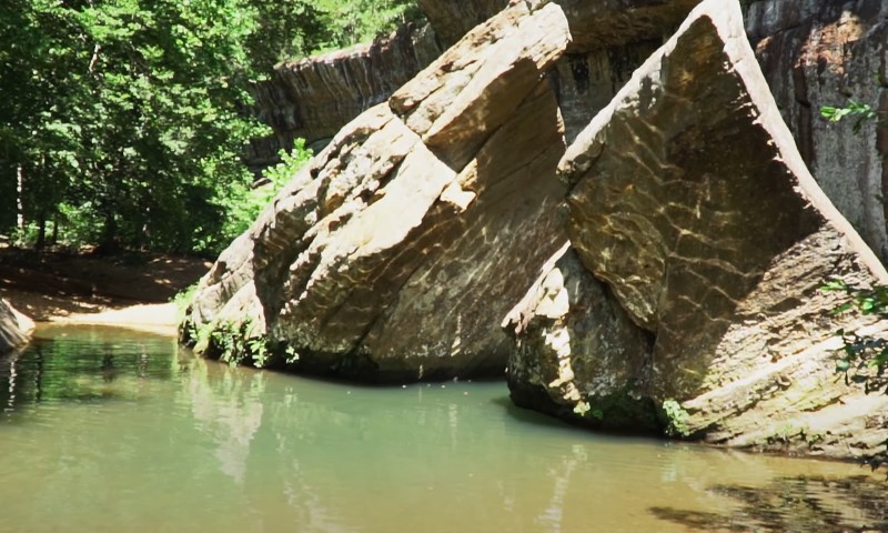
If you’re short on time, start here. The Natural Bridge is the showpiece of Bell Smith Springs and one of the most photographed landmarks in southern Illinois. Stretching about 125 feet long and 30 feet high , it’s the largest natural bridge in Shawnee National Forest .
Why It’s Special
The span was formed as Bay Creek eroded softer layers beneath harder sandstone, leaving a wide arch that you can both stand under and walk across.
The area around it is full of shallow creek pools, smooth rock shelves, and shaded bends where water stays surprisingly cool even in July.
Distance and Difficulty
Roughly 1.5 miles round-trip , marked by yellow blazes. The terrain is easy to moderate, with a few steep steps and some slick sandstone near water crossings.
Route Highlights
- Descend the stone stairway from the parking lot into the gorge.
- Follow yellow blazes along Bay Creek.
- Cross the creek on stepping stones or by wading if the water’s up.
- Pass several clear pools, then climb gently toward the bridge.
- Take the short spur to walk on top of the arch for canyon views.
Pool Tip
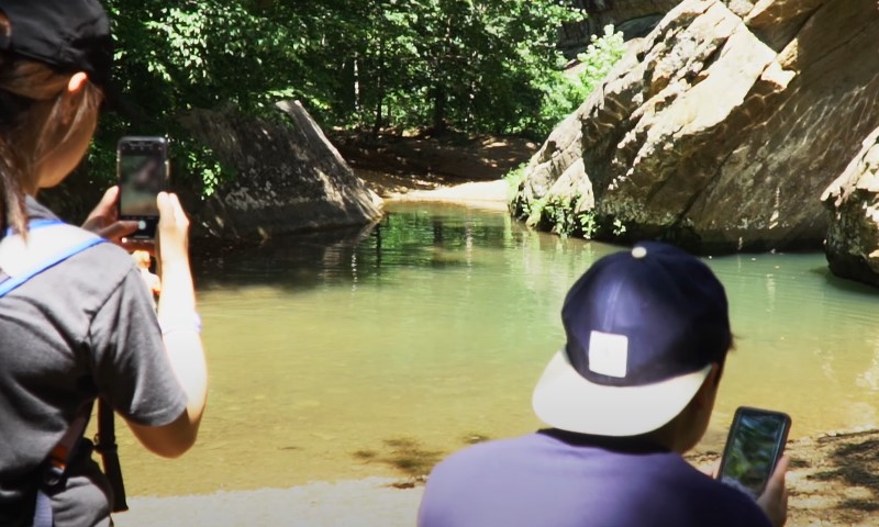
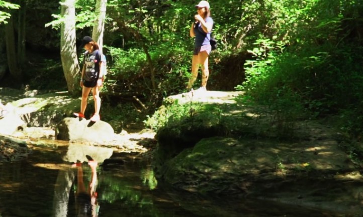
Just below the bridge, Bay Creek forms deeper basins carved into the rock. Those are the go-to swimming and wading spots. Bring water shoes, and remember: no glass is allowed anywhere in the canyon.
Sentry Bluff Trail (Blue)
If you want more legwork and sweeping views, Sentry Bluff delivers. The blue-blazed trail runs along the northeast rim of the canyon , giving you an overhead perspective of Bay Creek twisting below.
Why It’s Worth It
You’ll get airy overlooks, sandstone glades , and wildflowers in spring. It’s quieter than the Natural Bridge loop, so it’s ideal if you prefer more solitude or want to photograph without crowds.
Distance and Difficulty
Expect 3 to 3.5 miles , moderate difficulty. Elevation gain is about 280 feet, with sections that hug the cliff edge. Some stretches can stay muddy after rain.
Hiking Notes
- Start from the Natural Bridge Trail and continue onto blue blazes .
- The path rolls along the rim with intermittent overlooks.
- Loop back down toward Bay Creek to reconnect with other color trails.
- Good traction helps here – sandstone ledges can get slick when damp.
Wildlife and Plant Life
The upper glades host sun-loving species like little bluestem and prickly pear, while shaded spots bloom with columbine and shooting star in spring.
If you’re patient, you might spot red-tailed hawks gliding over the canyon or hear wood thrushes in the creek bottom.
Hill/Mill Branch Trail (Red)
For a slower pace, the red trail follows a smaller tributary north of Bay Creek. It’s shaded, lush, and lined with mossy rock shelters – perfect for a peaceful stroll.
What to Expect
This route meanders through ravines and ferny banks , sometimes with small waterfalls after heavy rain. It reconnects to the main network, so you can make it a loop or an out-and-back add-on.
- Distance: 1–2 miles depending on how far you go.
- Difficulty: Easy to moderate, with occasional roots and slick stone.
- Tip: After rain, water levels can rise quickly. Be cautious crossing streams.
Scenic Landmarks to Look For
| Spot | What It Is | Best For |
| Devil’s Backbone | Narrow sandstone ridge above Bay Creek | Sunrise or early morning photos |
| Boulder Falls | Small seasonal waterfall | Best after recent rain |
| Stone Stairway | Historic carved entryway from parking lot | Photos, geology lovers |
| Natural Bridge | 125-foot sandstone arch | Hiking and creek pools |
Natural Pools
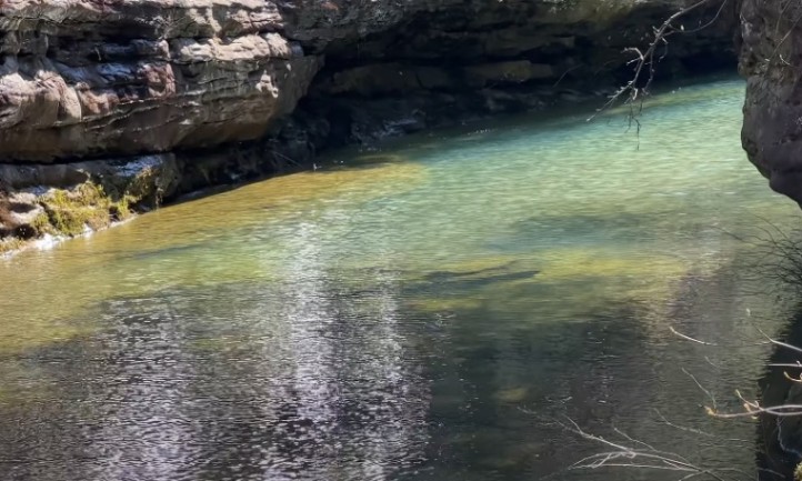
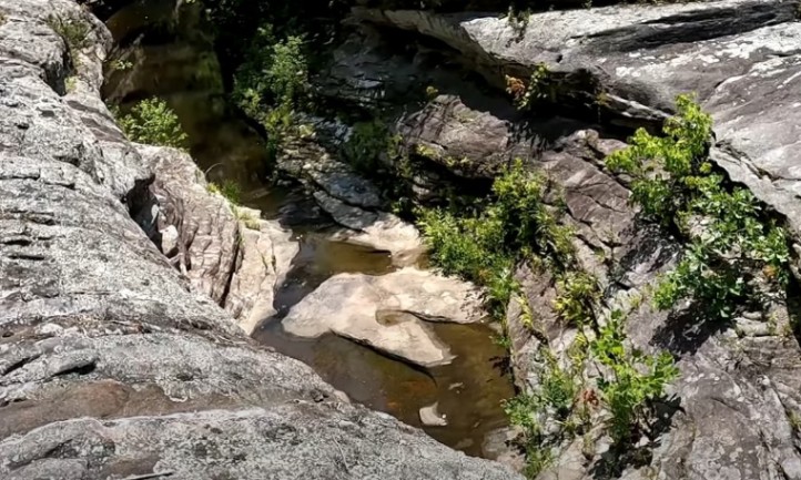
Bell Smith Springs isn’t just for hiking – it’s one of the most beloved swimming spots in southern Illinois. The creek’s turquoise tone comes from its limestone and sandstone base, which filters sediment and keeps the water strikingly clear.
Where the Pools Form
- Below bedrock shelves: Flat rock layers create sudden drop-offs where deeper basins hold water year-round.
- At creek bends and confluences: The current scours out pools while keeping them clean and cool.
You’ll find reliable pools:
- Below the Natural Bridge , especially downstream.
- Along Bay Creek near the yellow and blue trail junctions .
- Occasionally near the red trail tributaries after rain.
Safety and Etiquette
- Swim at your own risk. There are no lifeguards.
- Never jump into water you haven’t checked for depth.
- Avoid glass. Rangers strictly enforce the ban to prevent injuries.
- Pack out everything, including food wrappers and cans.
- Leave no soap or sunscreen residue in the creek – it harms aquatic life.
A good setup is lightweight sandals or water shoes, a dry bag for your phone, and a towel tucked in your daypack.
Suggested Day Plans
Whether you have a few hours or a full day, Bell Smith Springs offers trail combinations that fit every schedule. Here’s how to plan yours.
Short Visit (2–3 Hours)
- Start at the stone stairway, follow yellow blazes to the bridge.
- Pause at the pools below for a snack or a quick dip.
- Loop back via the creekside section.
- Optional: Add a short section of red trail if time allows.
Half-Day Adventure
- Begin with the Natural Bridge loop .
- Continue onto the blue trail for canyon-rim views.
- Picnic at an overlook before descending back to the main creek.
- Bring plenty of water – the ridge is exposed in places.
Full Value Loop
- Combine yellow + blue + red + white for roughly 8 miles of hiking.
- Expect multiple creek crossings and varied terrain.
- Start early, and check weather forecasts since Bay Creek can rise fast .
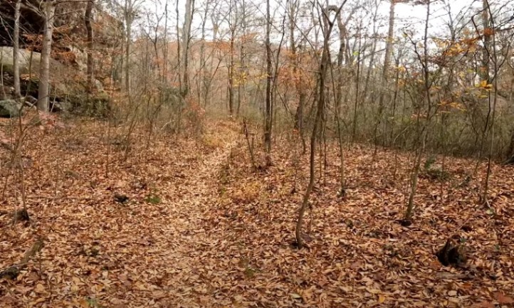
Best Seasons to Visit
| Season | Why Go | Conditions |
| Spring | High creek flow, waterfalls, wildflowers | Some crossings calf-deep or higher |
| Summer | Warm water and swimming weather | Crowds midday weekends |
| Fall | Vivid foliage, crisp air | Dry creek beds but clear pools |
| Winter | Quiet trails, great visibility for photography | Icy sandstone, low sun |
Spring brings carpets of wildflowers across the canyon benches – columbine, trillium, wild ginger, and shooting star among them. If that’s your thing, plan your visit for April or May .
Safety, Rules, and Essentials
Before you head down into the canyon, it helps to know a few ground rules. Bell Smith Springs is beautiful but rugged, and a little prep goes a long way.
What to Know Before You Go
- No glass containers. Rangers patrol and ticket for violations.
- Pets allowed on leash only. Keep them safe from cliffs and snakes.
- Foot traffic only. No bikes or horses.
- Day-use only. Camp overnight at Redbud Campground .
- Check weather before your trip. Heavy rain can make crossings impassable.
Trail Conditions and Hazards
- Water crossings: Expect calf-deep wades in spring.
- Cell service: Spotty at best. Tell someone your route.
- Poison ivy and snakes: Both common. Watch where you step and reach.
- Heat: Summer humidity can be brutal. Carry more water than you think you need.
Getting There
From IL-145 , near Eddyville, take Bell Smith Springs Road east for several miles. It’s a mix of pavement and gravel, with occasional potholes but fine for regular cars in good weather. The main lot sits at the top of the canyon, clearly signed.
Redbud Campground
If you want to stay close, Redbud Campground is less than a mile from the main trailhead. It’s small, quiet, and basic:
- About 21 sites , first-come, first-served.
- Vault toilets and self-pay station .
- No hookups or showers.
- Fees historically around $10 per night .
The campground makes an ideal base if you want to hike Bell Smith Springs one day and nearby Burden Falls Wilderness or Jackson Falls the next.
Sample One-Day Itinerary
View this post on Instagram
If you only have a day at Bell Smith Springs, you can still see the highlights. Here’s a simple plan that balances hiking, swimming, and quiet time.
Morning
Arrive around 8:30 a.m. to get ahead of the crowd. Start down the stone steps, walk the Natural Bridge Trail counterclockwise, and enjoy soft morning light on the creek. Pause at the pools below the bridge for a quick dip or snack.
Midday
Continue to Sentry Bluff Trail. Stop for lunch at a rim overlook with a wide view of the forest. Watch for hawks and woodpeckers.
Afternoon
Drop back into the gorge, wade a calm section of Bay Creek to cool your feet, then add a short leg on Mill Branch to visit a fern-filled side canyon.
Evening
Head back to the parking lot before sunset if you’re driving out. If camping, return to Redbud , cook dinner, and stroll the campground at dusk when whip-poor-wills start calling.
Leave No Trace in a Fragile Canyon
Bell Smith Springs isn’t just scenic – it’s scientifically important. Its designation as a National Natural Landmark means the site protects rare plant communities and unique geology. Small actions matter here:
- Stay on marked trails and rock surfaces.
- Never climb or write on sandstone walls.
- Carry out everything, even food scraps.
- Avoid loud music – sound carries in the canyon.
- Skip soaps and shampoos in the creek.
The Forest Service emphasizes that the area’s delicate ecosystems are part of its protected status. Its wild beauty is worth keeping that way.
FAQs
Nearby Add-Ons
If you’ve got extra time, there’s more Shawnee beauty within a short drive:
- Burden Falls Wilderness: One of Illinois’s tallest waterfall cascades, especially after rain.
- Jackson Falls: A boulder-filled gorge popular with rock climbers and photographers.
- Millstone Bluff Archaeological Site: Ancient Mississippian village site with petroglyphs and interpretive signage.
Each adds a different flavor to your southern Illinois adventure.
Final Tips Before You Go
- Check the USDA Forest Service Bell Smith Springs page for closures or water-level alerts.
- Bring two liters of water per person minimum in warm weather.
- Carry a dry bag for electronics and car keys if you plan to wade.
- Wear traction footwear with grippy soles.
- Respect the no-glass rule – it’s there for safety and conservation.
Bell Smith Springs rewards anyone willing to slow down and explore. Between the soaring bridge, clear pools, and rugged sandstone, it captures something rare: a taste of true wilderness in the heart of Illinois. If you walk out tired, muddy, and smiling, you’ve done it right.