I consider Death Valley National Park one of the most extreme and fascinating places in the United States. It holds the record for one of the hottest air temperatures ever recorded on Earth at 134 °F, and it contains the lowest point in North America at 282 feet below sea level.
Conditions are dry, dramatic, and powerful. Salt flats stretch for miles, dunes rise in soft curves, mountains shift color with the light, and volcanic craters remind me how active this region once was.
Spending three full days here gives me enough time to experience the major sights at a comfortable pace.
I can enjoy key hikes, panoramic viewpoints, iconic photo spots, and quiet desert evenings without rushing. Fall, winter, and spring offer the safest and most comfortable conditions.
Summer temperatures often climb past 120 °F, which can make outdoor activity dangerous.
Let me show you my 3-day experience in Death Valley, which you will find useful. I am certain of that.
Day #1 – Classic Death Valley Stops
View this post on Instagram
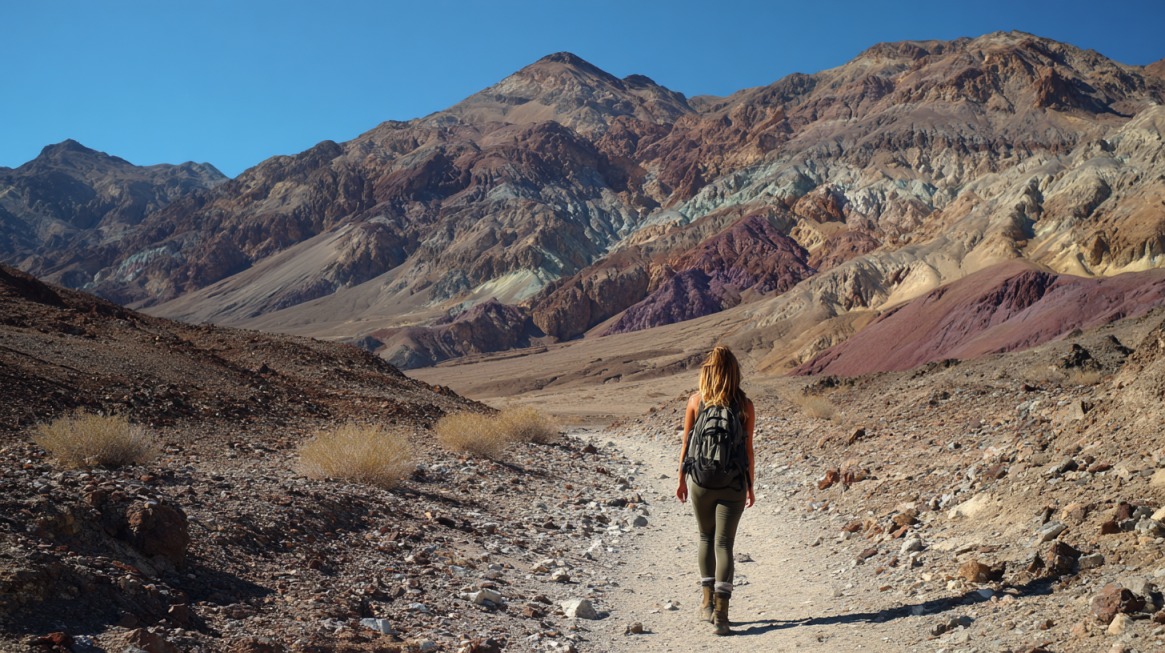
The first day focuses on well-known sights and dramatic viewpoints. I keep driving distances manageable and aim for a mix of short walks and scenic stops.
Morning
Furnace Creek Visitor Center is my starting point. Rangers provide current updates, and exhibits give helpful context about geology and mining history. I pick up a park brochure and confirm that the roads on my plan are open.
Harmony Borax Works Interpretive Trail comes next. Short paths loop past remains of the old borax processing site. Informational panels describe the twenty mule teams that once hauled borax across the desert for miles.
Twenty Mule Team Canyon Drive follows as a scenic dirt route through eroded hills. Slow driving allows me to notice color changes in the rock layers. I take my time and stop at safe pullouts for photos.
Midday
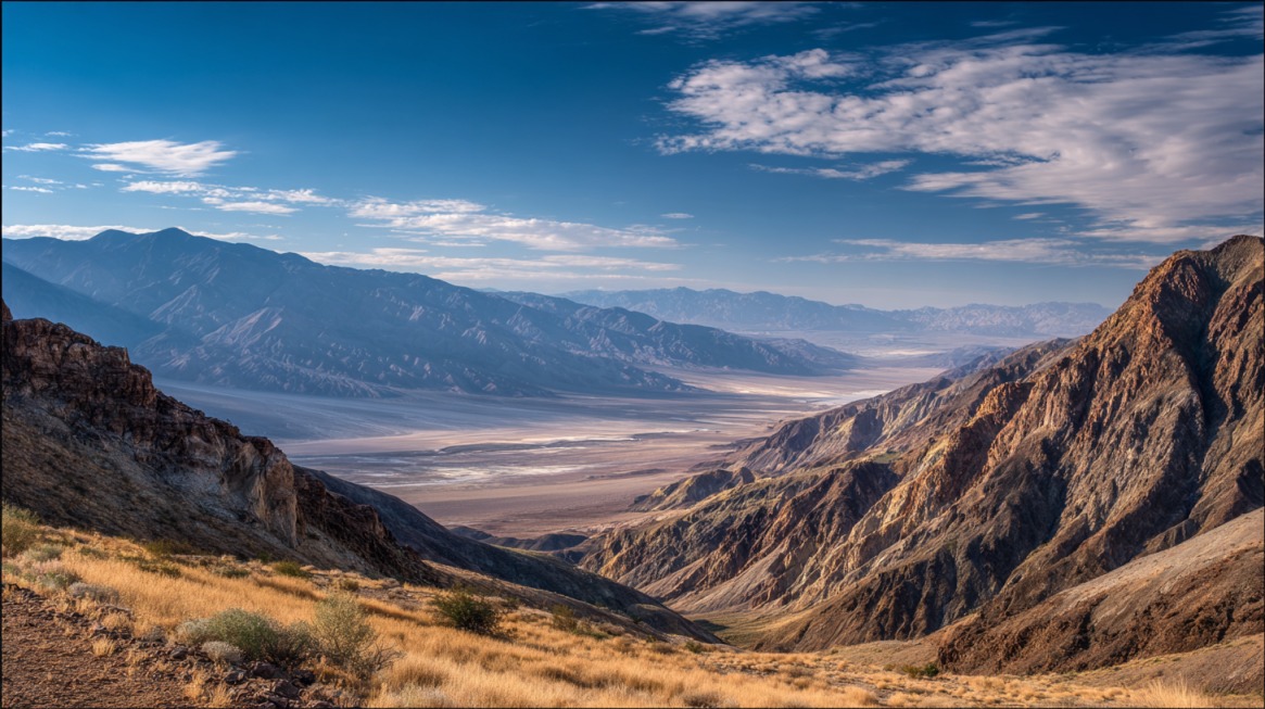
Dante’s View offers a dramatic contrast in elevation.
- Elevation of about 5,575 feet above the valley floor
- Sweeping views across Badwater Basin
- Cooler temperatures compared to lower elevations
Air often feels noticeably cooler at the top. I spend time taking photos and scanning the vast salt flats below.
Lunch usually involves a picnic. I either stop at the Furnace Creek general store or bring prepared food. Carrying my own meals keeps the schedule flexible and reduces time spent waiting in lines.
Afternoon
Badwater Basin marks the lowest point in North America at 282 feet below sea level. I walk onto the salt flats and notice geometric salt patterns under my shoes. Bright white ground contrasts with dark mountain slopes in the distance.
Artist’s Drive fills the late afternoon.
- Colorful volcanic hills shaped by mineral deposits
- Artist’s Palette overlook with pink, green, and gold tones
- Smooth paved road suitable for most vehicles
Late afternoon light enhances the colors and adds depth to the hills.
Evening
Zabriskie Point is my sunset destination on day one. Rolling badlands create long shadows as the sun drops. Parking fills quickly, so I arrive early and walk to the viewpoint before peak sunset time.
Day #2 – Western Views and Distinct Sites
The second day shifts attention toward dunes, canyon vistas, and historic structures. I start early again to take advantage of cooler temperatures.
Morning
Mesquite Flat Sand Dunes look best in soft morning light. Wind reshapes the ridges overnight, creating smooth lines across the sand. I walk toward taller dunes for broader views and fewer footprints.
Darwin Falls offers a surprising contrast in this arid region. Access depends on road conditions, so I confirm status before heading out. Short hike leads to a small waterfall and greenery sustained by year round water.
Midday
Salt Creek Interpretive Trail introduces a marsh habitat that feels unexpected in such a dry environment. Seasonal water supports the Salt Creek pupfish, a small fish found only in this area. Boardwalk sections protect the fragile habitat and keep my shoes dry when water is present.
I usually pause near Stovepipe Wells for lunch. Picnic tables and nearby services make it a convenient break point.
Afternoon
Father Crowley Vista Point provides wide canyon views and dramatic drop-offs. Rainbow Canyon lies nearby and is known for military flight training routes. Jets occasionally pass through the canyon at high speed, creating an exciting moment for visitors who happen to be there at the right time.
Wildrose Charcoal Kilns require a drive along Emigrant Canyon Road.
- Built in the 1870s
- Beehive-shaped design
- Used to produce charcoal for nearby mining operations
High elevation at this site often brings cooler air and occasional snow in winter.
Evening
Dinner at Stovepipe Wells Toll Road Restaurant offers a relaxed ending to the day. Simple meals taste especially satisfying after hours outdoors. I often step outside afterward to watch fading light over nearby hills.
Day #3 – Canyons, Hikes, and Craters
The final day focuses on longer hikes and volcanic features. I pace myself and monitor temperatures closely.
Morning
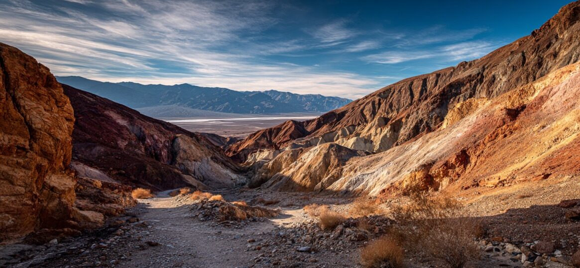
Golden Canyon and Gower Gulch Loop Trail ranks among my favorite hikes in the park. Distance typically ranges from 4 to 5 miles, depending on route choice. Tall rock walls rise on both sides, and colors shift between gold, red, and tan.
- Early start to avoid midday heat
- Carrying at least one gallon of water per person
- Wearing sturdy shoes for uneven terrain
Trail can connect to Zabriskie Point if I want to extend the route.
Midday
Borax Museum near Furnace Creek provides a short historical stop. Exhibits display mining equipment, photos, and tools used during the borax era. A visit usually takes less than an hour, making it easy to fit into the schedule.
Afternoon
Ubehebe Crater delivers a dramatic geological feature to close out major sightseeing. Crater measures about 600 feet deep. Rim trail forms a loop of approximately 1.5 miles.
Loose gravel lines parts of the rim, so I walk carefully and maintain distance from steep edges. Views into the crater reveal layered volcanic deposits and dark cinder fields.
If time and energy allow, I add a short slot canyon hike or revisit a favorite viewpoint for different lighting.
Evening
I like ending my visit with another sunset or extended stargazing session. Death Valley holds Gold Tier International Dark Sky Park status. On clear nights, Milky Way stretches visibly across the sky. I move away from developed areas and allow my eyes to adjust for at least twenty minutes.
Practical Trip Planning
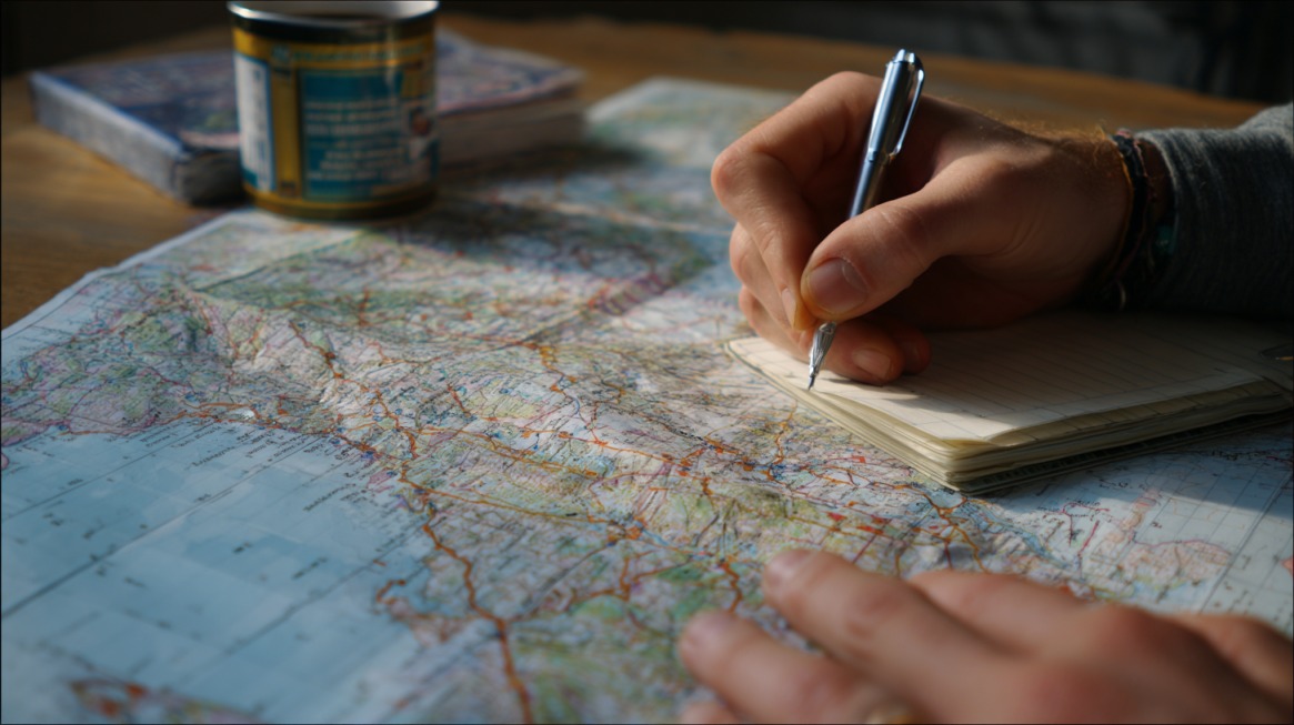
Careful planning makes my time in Death Valley smoother and safer. Vast distances, limited services, and intense weather require more preparation than many other national parks. I treat logistics as part of the adventure, not an afterthought.
Getting There and Drive Times
Major gateway cities sit several hours away, so timing matters. I plan my departure early in the day to avoid driving unfamiliar desert roads after dark.
- Las Vegas: about 2¼ hours
- Los Angeles: about 4½ hours
- San Francisco: about 8½ hours
Traffic leaving large cities can add unexpected delays, especially around Los Angeles. I factor in extra time for rest stops and fuel breaks before reaching remote highways.
Fuel, Navigation, and Road Awareness
Long desert highways mean fewer services as I get closer to the park. Fuel stations inside park boundaries are limited and prices are higher than in nearby cities.
I always fill up my gas tank before entering and reset my trip odometer to track mileage.
- Download offline maps before losing cell signal
- Carry a printed park map as backup
- Keep an eye on fuel level once it drops below half a tank
- Avoid unnecessary detours on low fuel
Towns are far apart, and cell service drops in many areas. Roadside assistance can take time to arrive, especially on less-traveled routes. I avoid assuming help will be close by.
Park Size and Distances
View this post on Instagram
Death Valley covers over 3 million acres, placing it among the largest national parks in the lower 48 states. Sheer scale surprises many first-time visitors. Distances between major stops can easily stretch 30 to 60 miles.
Driving times inside the park often take longer than expected due to speed limits, scenic pullouts, and winding mountain roads. I never assume that two points on a map are close just because they appear nearby. I group nearby stops together on the same day to reduce unnecessary backtracking.
Weather and Road Conditions
Preparation shapes the entire experience. Before arrival, I review current alerts and road status updates. Flash floods and storm damage sometimes close roads such as Twenty Mule Team Canyon or sections leading to Ubehebe Crater.
Desert weather can shift quickly. Heavy rain in the surrounding mountains may send water rushing across low roads hours later. I avoid driving through standing water and always respect road closure signs.
Essential Packing and Safety Gear
Heat, dryness, and isolation require careful packing. I build my list around safety first, comfort second.
- Multiple gallons of water per person per day
- Wide brim hat, sunscreen, and sunglasses
- High energy snacks and electrolyte replacements
- Extra layers for cold mornings and evenings
- Basic vehicle emergency kit with spare tire, jack, and tools
I also keep extra water in the car even on short hikes. Hydration needs increase quickly in dry air, even during cooler months.
Temperatures swing dramatically across elevations. Winter mornings may begin near freezing at higher viewpoints like Dante’s View at about 5,575 feet. Valley floor temperatures rise much higher by afternoon. Layered clothing allows me to adjust throughout the day.
Choosing Where to Stay
Base location affects daily driving time and overall pace. Furnace Creek works best for me because it sits near the center of the park. Staying there shortens travel time to several major attractions.
- Campgrounds with limited hookups
- Easy access to the visitor center
- Short drives to Badwater Basin and Zabriskie Point
- Nearby general store and basic services
Stovepipe Wells Village places me closer to the Mesquite Flat Sand Dunes. I appreciate having several services within walking distance:
- Fuel station
- General store
- Restaurant and bar
Panamint Springs and Mesquite Camp sit on the western and northern sides of the park. Services are more limited in those areas, yet traffic is lighter and night skies feel even darker. Longer drives to central attractions are the trade off.
The Bottom Line
Three full days in Death Valley allow me to experience salt flats, dunes, badlands, canyons, and volcanic craters at a comfortable pace. I can mix scenic drives with moderate hikes and still leave space for quiet desert moments.
Season, weather, crowd levels, and my own energy shape how I adjust each day. With thoughtful planning and respect for conditions, Death Valley becomes one of the most memorable destinations in the American West.